Mapping
Before we can excavate a site we need to know how large it is and how it is situated in the landscape. We also want to record all of its features that are visible on the surface. While this may seem quite straightforward, creating an accurate map actually requires a lot of time and equipment. Since we are recording many sites on Mograt for the first time, it is also important to produce precise data about their location so that other archaeologists can find them in the future for further study.
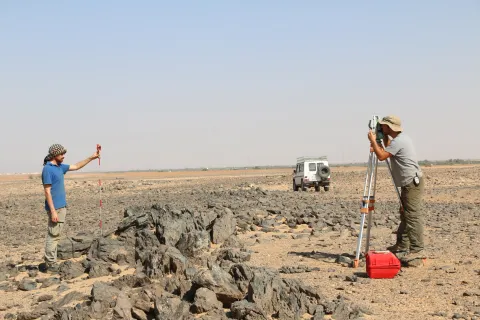
For mapping, we use an EDM (electronic distance measurer), like the one in the photo. It is a complex instrument, but basically, all we have to do is to indicate the point we want to measure with a reflector. The machine sends a laser impulse towards this reflector and calculates the exact distance towards it. Finally, all these individual measurements are transferred onto the computer, where the single points can be joined and a map can be produced.
Exact maps which show the extension of a site, relevant landscape elements and archaeological features visible at the surface help us to understand the structure of a site – and once we know where we are, we can excavate!

